Lost at sea with no GPS signal in sight, the ancient art of celestial navigation emerges as a beacon of hope for sailors navigating the vast expanse of the open ocean. In a world dominated by cutting-edge technology, the age-old practice of celestial navigation continues to captivate sailors and explorers with its timeless elegance and unwavering reliability. Beyond the confines of modern navigation systems, celestial navigation offers a connection to the stars, a reminder of the ingenuity of ancient civilisations, and a lifeline for mariners facing the unpredictable forces of the sea. Join us on a journey ‘Beyond the Horizon,’ as we explore the fascinating realm of celestial navigation and its enduring significance in the maritime world.
The History and Importance of Celestial Navigation
As a sailor, delving into the origins of celestial navigation feels like a journey back through time, connecting with the ancient seafaring traditions that have guided mariners for centuries. It’s fascinating to trace the roots of celestial navigation to civilisations like the Polynesians and Greeks, who possessed an intimate understanding of the stars long before the advent of GPS or sophisticated navigation instruments. The Polynesians, renowned for their mastery of wayfinding, navigated vast expanses of the Pacific Ocean using a deep knowledge of celestial bodies, ocean currents, and natural signs like bird migrations. Their ability to interpret the subtle movements of stars, such as the rising and setting of certain constellations, enabled them to chart courses across seemingly endless oceans with remarkable accuracy.
Similarly, the ancient Greeks contributed significantly to the development of celestial navigation, laying the groundwork for the mathematical principles that underpin modern navigation techniques. Greek astronomers like Hipparchus and Ptolemy meticulously observed the movements of celestial bodies and devised mathematical models to predict their positions in the sky. Their discoveries not only expanded our understanding of the universe but also provided sailors with essential tools for navigating the open seas. From the earliest star charts to the invention of the astrolabe, Greek scholars pioneered advancements that continue to influence navigation practices to this day. As a sailor, I’m inspired by the ingenuity and perseverance of these ancient navigators, whose legacy lives on in the celestial dance that guides us across the ocean’s expanse.
The critical role of celestial navigation in maritime exploration and trade throughout history cannot be overstated. As civilizations expanded their horizons and ventured into unknown waters, celestial navigation provided a reliable means of determining position and charting courses across vast oceans. Without the aid of modern technology, sailors relied on the positions of the sun, moon, stars, and planets to navigate with precision, often braving treacherous conditions and enduring lengthy voyages. The ability to accurately plot their course using celestial observations not only facilitated trade routes but also paved the way for the exploration and colonisation of distant lands.
However, celestial navigation was not without its challenges. One of the greatest hurdles faced by early sailors was the need for accurate timekeeping. The importance of precise timekeeping in celestial navigation is underscored by its direct correlation with latitude estimation; a mere discrepancy of 1 minute can result in a staggering positional error of up to 16 nautical miles. Recognizing this limitation, maritime nations embarked on a quest for better timekeeping devices, leading to fierce competition and innovation. This competition ultimately culminated in the development of the first marine chronometer by John Harrison in the 18th century. Harrison’s revolutionary timepiece, which could maintain accurate time despite the motion and temperature variations experienced at sea, marked a turning point in maritime navigation, drastically improving the accuracy and reliability of celestial navigation techniques.
I’ve come to appreciate celestial navigation not only for its historical significance but also for its practical importance as a backup or alternative to modern GPS systems, particularly in remote areas or during emergencies. While GPS technology has undoubtedly transformed maritime navigation, relying solely on it can pose risks, especially when considering potential system failures or disruptions due to technical glitches, signal interference, or even malicious interference. In such scenarios, celestial navigation emerges as a dependable fallback, offering a timeless method of determining a vessel’s position using celestial bodies independent of electronic devices. This becomes particularly crucial in remote regions where GPS signals may be weak or unavailable, leaving sailors to navigate through uncharted waters or unfamiliar territories with confidence born from celestial observations. Additionally, during emergencies such as equipment malfunctions or power outages, the ability to navigate using celestial cues can be a lifesaving skill, providing sailors with a reliable means of finding their way to safety amidst challenging circumstances. Thus, while modern technology has undoubtedly revolutionised navigation, the enduring reliability and resilience of celestial navigation serve as a reassuring beacon for sailors navigating the unpredictable seas.
Understanding the Basics of Celestial Navigation

Fundamental Principals
Navigating by the sun’s celestial cues remains a cornerstone of celestial navigation, relying on fundamental principles that have guided sailors for centuries. To determine latitude using the sun, sailors measure the angle between the horizon and the sun at its highest point in the sky, known as solar noon. This angle, called the altitude, provides a direct indication of the vessel’s distance from the equator. At the equator, the sun appears directly overhead, resulting in a maximum altitude, while at higher latitudes, the sun angles lower in the sky, indicating a more northerly or southerly position. By referencing tables or formulas that correlate solar altitude with latitude and factoring in seasonal variations, sailors can precisely determine their vessel’s position north or south of the equator.
In addition to latitude, celestial navigation also entails determining longitude, which necessitates precise timekeeping in conjunction with solar observations. Unlike latitude, which can be determined solely based on solar altitude, longitude requires tracking the sun’s apparent motion relative to a fixed reference point over time. This involves noting the local solar time when the sun reaches its highest point in the sky, known as solar noon, and comparing it with the time at a known reference point, such as the Greenwich Meridian. The difference in time between these two points corresponds to the vessel’s longitudinal displacement from the reference meridian, with each hour of difference representing 15 degrees of longitude. By combining latitude and longitude calculations derived from solar observations, sailors can pinpoint their exact position on the Earth’s surface with remarkable precision, exemplifying the timeless art and science of celestial navigation.
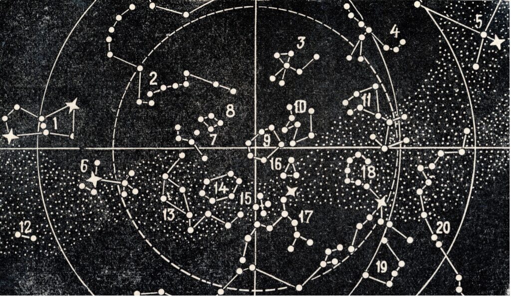
The fundamental principles of using celestial bodies for navigation extend beyond the sun, encompassing stars, the moon, and planets as reliable reference points for determining position and course. By observing the celestial sphere and noting the apparent positions of these bodies relative to the observer’s horizon, sailors can derive valuable navigational information. Stars, with their fixed positions relative to one another, serve as dependable markers for establishing direction and orientation, particularly during night time when the sun is not visible. Similarly, the moon’s predictable orbit and distinctive phases offer sailors a secondary means of determining time, direction, and latitude, complementing solar observations. Furthermore, planets such as Venus, Mars, Jupiter, and Saturn, with their distinguishable brightness and predictable movements against the backdrop of stars, provide additional celestial landmarks for navigation. By understanding the cyclical patterns and celestial mechanics governing these bodies, sailors can navigate with confidence, drawing upon the timeless principles of celestial navigation to traverse the world’s oceans with skill and precision.
Tools and Instruments
Central to the practice of celestial navigation are the essential tools and instruments that enable sailors to make accurate observations of celestial bodies. Foremost among these instruments is the sextant, a precision optical device used to measure the angle between a celestial body, typically the sun or a star, and the horizon. By aligning the sextant’s sighting mechanism with the horizon and the chosen celestial body, sailors can obtain an accurate angular measurement, known as the altitude or the celestial body’s altitude above the horizon. This measurement forms the basis for calculating the observer’s position on the Earth’s surface. The sextant’s design allows for precise adjustments and readings, making it indispensable for celestial navigation even in adverse weather conditions or challenging sea states.
Accompanying the sextant in the navigator’s toolkit is the nautical almanac, a comprehensive reference publication containing precise tables and data crucial for celestial navigation calculations. Nautical almanacs provide essential information such as the predicted positions of celestial bodies at various times throughout the year, as well as correction factors for factors like atmospheric refraction and parallax. Armed with this data, sailors can accurately predict the positions of celestial bodies relative to the observer’s location, facilitating the calculation of latitude and longitude. Additionally, nautical almanacs often include supplementary tables and charts for celestial phenomena such as lunar distances, aiding in more advanced celestial navigation techniques. Together, the sextant and nautical almanac form the backbone of celestial navigation, empowering sailors to navigate the vast expanse of the open ocean with precision and confidence.
A worked example: As solar noon approaches in the first week of August, the sailor prepares to take a sight of the sun’s altitude using a sextant. At solar noon, when the sun reaches its highest point in the sky, the sailor carefully aligns the horizon with the horizon mirror of the sextant and the sun with the index arm. With steady hands and keen observation, the sailor adjusts the sextant until the reflection of the sun touches the horizon in the index mirror, indicating that the altitude measurement is accurate. At this moment, the sailor reads the angle displayed on the sextant’s vernier scale, which represents the altitude of the sun above the horizon.
Let’s say, for the sake of this example, that the sailor records an altitude of 60 degrees for the sun at solar noon. Alongside recording the altitude measurement, the sailor also notes the local time corresponding to the exact moment of the observation. In celestial navigation, the time of the observation is crucial for determining longitude, as it provides a reference point for comparing against the time at a known reference meridian, such as Greenwich Mean Time (GMT). By recording the local time of the observation alongside the altitude measurement, the sailor can later calculate the difference between local time and GMT, which, when converted to degrees, represents the yacht’s longitudinal displacement from the Greenwich Meridian. This information, combined with additional observations and calculations using celestial navigation techniques, allows the sailor to precisely determine the yacht’s position on the Earth’s surface.
Practical Applications of Celestial Navigation
Celestial navigation proves invaluable in various real-world scenarios, offering sailors a reliable means of navigation even in the absence of modern technology. One such scenario occurs during long ocean passages, where sailors may find themselves far from shore and reliant on their navigational skills to reach their destination safely. In these remote and often unpredictable environments, celestial navigation serves as a dependable backup to electronic navigation systems, providing sailors with a method to verify their position and course using celestial bodies such as the sun, stars, and planets. By taking regular celestial sights and calculating their position using traditional techniques, sailors can maintain confidence in their navigation, mitigating the risk of getting lost or off course during extended voyages across vast expanses of open ocean.
Similarly, celestial navigation plays a crucial role in yacht racing, where precision and accuracy are paramount. Yacht racers often compete in challenging conditions where electronic navigation systems may be prone to malfunction or interference, making celestial navigation an essential skill for navigating with confidence and accuracy. One practical application of celestial navigation in yacht racing is checking the accuracy of a yacht’s compass by measuring the true bearing of the sun at sunrise. By comparing the observed bearing of the sun with the yacht’s magnetic compass reading, sailors can detect any deviation or errors in the compass calibration, allowing for timely adjustments to maintain course accuracy throughout the race. This reliance on celestial navigation not only enhances the competitive edge of yacht racers but also ensures their safety and navigation prowess in demanding racing conditions where every second and degree count.
Despite its reliability and historical significance, celestial navigation is not without its challenges and limitations. One of the primary challenges faced by sailors practicing celestial navigation is the influence of weather conditions on celestial observations. Cloud cover, fog, and adverse weather can obstruct visibility, making it difficult or impossible to obtain accurate sightings of celestial bodies. In such conditions, sailors may struggle to determine their position or course, increasing the risk of navigational errors and potential hazards. Additionally, celestial navigation requires clear horizons for accurate measurements, which may be limited in congested or coastal areas with obstructed views. Another significant challenge is the potential for human error in taking and interpreting celestial sightings. Precision and attention to detail are essential in using instruments like sextants and accurately recording observations. Even minor errors in measurement or calculation can lead to significant discrepancies in determining a vessel’s position, underscoring the importance of thorough training and practice in celestial navigation techniques. Despite these challenges, skilled sailors recognize the value of celestial navigation as a timeless and dependable method of navigation, capable of guiding them safely across the world’s oceans with diligence and expertise.
For sailors interested in learning and mastering celestial navigation techniques, there are several tips and best practices to consider. Firstly, obtaining a solid understanding of the basic principles of celestial navigation is essential. This includes familiarizing oneself with the celestial bodies used for navigation, understanding how to use navigation tools such as sextants and nautical almanacs, and mastering the calculations involved in determining position and course. Additionally, regular practice is key to proficiency in celestial navigation. Sailors should aim to take celestial sights regularly, even during short voyages or outings, to hone their skills and maintain confidence in their ability to navigate using celestial cues. It’s also beneficial to seek out opportunities for hands-on training and instruction from experienced navigators or maritime schools specializing in celestial navigation. Furthermore, staying updated on advancements in navigation technology and resources, such as electronic navigation aids and software applications, can complement traditional celestial navigation techniques and enhance overall navigational capabilities. By embracing a combination of theoretical knowledge, practical experience, and ongoing learning, sailors can embark on a rewarding journey towards mastering the art and science of celestial navigation.
Celestial Navigation in the Modern Age
In the modern era, technology has revolutionized celestial navigation, complementing traditional methods with advanced tools and electronic aids. Software applications designed specifically for celestial navigation offer sailors a convenient and efficient means of performing complex calculations and obtaining celestial data. These applications often include features such as celestial almanacs, star charts, and sight reduction tools, allowing sailors to streamline the navigation process and obtain accurate position fixes with ease. Furthermore, electronic aids such as GPS receivers and inertial navigation systems provide invaluable support to celestial navigation by offering real-time position information and aiding in the verification of celestial observations. By integrating modern technology into celestial navigation practices, sailors can benefit from enhanced accuracy, efficiency, and reliability, particularly in challenging or dynamic navigational environments.
However, while technology offers numerous advantages in modern celestial navigation, it also presents certain considerations and limitations. Dependence on electronic aids may lead to a reliance on external systems, potentially diminishing sailors’ proficiency in traditional celestial navigation techniques. Furthermore, electronic devices are susceptible to technical malfunctions, signal interference, and power failures, which can compromise navigational accuracy and reliability. As such, sailors should maintain proficiency in manual celestial navigation methods and regularly verify electronic readings against celestial observations to mitigate the risk of navigational errors. By striking a balance between traditional and modern navigation techniques, sailors can harness the full potential of technology while preserving the time-honored art and science of celestial navigation.
Final thoughts
The art of celestial navigation stands as a testament to human ingenuity and resilience, offering sailors a timeless method of navigating the world’s oceans with confidence and precision. From its ancient origins to its modern-day applications, celestial navigation continues to play a vital role in maritime exploration, trade, and safety. Despite the advancements in technology, celestial navigation remains relevant, serving as a reliable backup or alternative to modern GPS systems, especially in remote areas or during emergencies.
As we’ve explored the history, principles, and practical applications of celestial navigation, it’s evident that this age-old practice holds immense value for sailors of all stripes. Whether embarking on long ocean passages, competing in yacht races, or simply honing navigational skills, celestial navigation offers a profound connection to the natural world and a deep appreciation for the celestial bodies that guide our journeys. As sailors, let us embrace the enduring legacy of celestial navigation, learning from the wisdom of ancient navigators while embracing the innovations of the modern age.
We invite you to share your thoughts and experiences with celestial navigation in the comments below. Have you ever practiced celestial navigation, or do you have any questions about this fascinating topic? Join the discussion and let’s continue to explore the wonders of celestial navigation together. Email hello@sailors.project1031.com to share your story.
References and Resources
- National Maritime Museum: Explore in-depth articles and resources about the history and techniques of celestial navigation, including its application in maritime exploration and the contributions of ancient civilizations. Visit the National Maritime Museum
- Starpath School of Navigation: Offers a comprehensive online course on celestial navigation, perfect for beginners and seasoned sailors looking to refine their skills. The course covers everything from the basics to advanced celestial navigation techniques. Check out the Starpath School of Navigation
- NOAA’s Introduction to Celestial Navigation: This guide by the National Oceanic and Atmospheric Administration (NOAA) provides a detailed overview of celestial navigation principles, tools, and practices. It’s a great starting point for anyone new to the topic. Read NOAA’s Introduction to Celestial Navigation
- The Celestial Navigation Net: A resource-rich website dedicated to celestial navigation, featuring tutorials, articles, and tools for navigators of all levels. The site also includes a forum for discussion and advice. Explore The Celestial Navigation Net
- The Royal Institute of Navigation: Engage with the latest research and developments in navigation, including celestial navigation. The institute publishes a wide range of articles, papers, and journals on navigation technology and practices. Visit The Royal Institute of Navigation
- ‘The Sextant Handbook’ by Bruce Bauer: This book is an essential guide for anyone interested in learning how to use a sextant. It covers the history, theory, and practical applications of sextants in celestial navigation. Find ‘The Sextant Handbook’ on Amazon
- Celestial Navigation Course on Coursera: This online course offers interactive lessons and practical exercises in celestial navigation, suitable for beginners and intermediate learners. Taught by experienced sailors and navigators, it’s a great way to get hands-on experience. Enroll in the Celestial Navigation Course on Coursera
- YouTube Tutorials on Celestial Navigation: A curated list of video tutorials that cover the basics of celestial navigation, including how to use a sextant, read nautical almanacs, and calculate your position using celestial bodies. Watch YouTube Tutorials on Celestial Navigation