In the vast expanse of the world’s oceans, where every wave and current presents a new challenge, sailors rely on a beacon of modern technology to navigate the waters with precision and confidence. Welcome aboard as we delve into the remarkable realm of marine GPS technology, a digital lifeline guiding seafarers through the boundless expanse of the ocean. From its inception to the cutting-edge innovations shaping the future of maritime navigation, join us as we embark on a journey to explore the evolution, precision, and integration of GPS systems in the maritime domain.
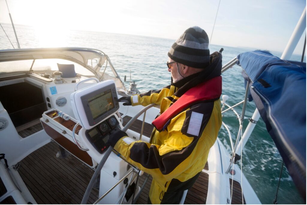
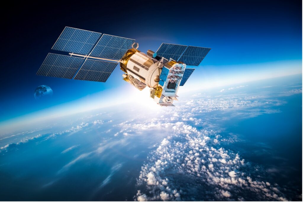
As we set sail into the heart of this technological marvel, let’s first uncover the fundamental workings of GPS and its transformative impact on maritime travel. The Global Positioning System, or GPS, has revolutionized navigation by providing sailors with unparalleled accuracy and reliability. With a constellation of satellites orbiting the Earth, GPS continuously transmits signals intercepted by receivers onboard vessels to precisely determine their location worldwide. Through a seamless fusion of satellite communication and precise timing, GPS guides sailors through the digital seas, ensuring safe passage and navigation efficiency in even the most challenging conditions.
Venturing further into the evolution of marine GPS technology, we uncover a rich tapestry of innovation and advancement. From its humble beginnings in the 1960s with the Transit satellite navigation system to the launch of the first Block I GPS satellite in 1978, each milestone has propelled maritime navigation into new frontiers. Throughout the decades, the GPS constellation has expanded, additional satellites deployed to enhance coverage and accuracy. The integration of modern technologies has further refined precision and reliability, revolutionizing navigation in commercial shipping, all the way through to yacht racing and cruising. As sailors continue to push the boundaries of speed and skill, GPS technology remains an indispensable companion, guiding them through the ever-changing currents of competitive sailing.
What is GPS and How does it work?
Let’s shed light on the marvel that is GPS, or Global Positioning System, for those unfamiliar with its workings. Imagine a sailor out at sea, navigating through vast waters, relying solely on the stars and landmarks for direction. GPS, however, has transformed maritime travel by providing a digital lifeline, guiding us with unmatched accuracy through the boundless expanse of the ocean.
Now, let’s delve into the mechanics of this technological wonder. GPS comprises a constellation of satellites orbiting the Earth, continuously transmitting signals that our receivers intercept to determine our precise location worldwide. Each satellite broadcasts its own position and the time the signal was sent. As our GPS receiver picks up signals from multiple satellites, it calculates the distance to each one based on the time it took for the signals to reach us. By triangulating these distances, the receiver precisely pinpoints our location on Earth’s surface through a process known as trilateration. This seamless fusion of satellite communication and precise timing forms the backbone of GPS technology, guiding sailors through the digital seas with unparalleled precision and reliability.
Evolution of Marine GPS Technology:
Back in the day, yacht racing relied heavily on traditional navigation methods, with sailors plotting their courses using charts, compasses, and celestial observations. It wasn’t until the late 20th century that GPS technology made its debut on the racing scene. The first iterations of marine GPS systems provided rudimentary positioning data, but even then, they were a game-changer for sailors seeking to gain an edge in precision navigation. It all started back in the 1960s when the United States Navy initiated the Transit satellite navigation system, which provided basic positioning capabilities to ships using low-Earth orbit satellites. This system laid the foundation for what would eventually evolve into the Global Positioning System we know today.
Fast forward to 1978 when the first Block I GPS satellite was launched into orbit, marking the dawn of a new era in navigation. Over the following decades, the GPS constellation expanded, with additional satellites being deployed to improve coverage and accuracy. In 1983, President Ronald Reagan announced that GPS would be made available for civilian use, opening up a world of possibilities beyond military applications.
Throughout the 1990s and early 2000s, significant advancements were made in GPS technology, including the introduction of selective availability, which intentionally degraded civilian signals for security reasons. However, this practice was discontinued in 2000, leading to a significant improvement in GPS accuracy for civilian users. Additionally, advancements such as the introduction of Differential GPS (DGPS) and Wide Area Augmentation System (WAAS) further enhanced the precision and reliability of marine GPS navigation.
In the modern era of yacht racing, GPS technology has become an integral part of our strategy and tactics on the water. Real-Time Kinematic (RTK) GPS systems now provide us with centimetre-level accuracy, allowing for precise course optimization and tactical decision-making. The integration of GPS with other onboard systems, such as wind instruments and performance monitors, has revolutionized the way we analyse race data and fine-tune our sailing techniques. As we continue to push the boundaries of speed and skill in yacht racing, one thing remains clear: GPS technology will continue to play a pivotal role in helping us navigate the ever-changing currents of competitive sailing.
Precision and Accuracy:
Let’s plunge into the depths of the latest innovations that have transformed marine GPS systems, ensuring precision and accuracy that were once mere dreams on the open water. First up, we have Differential GPS (DGPS), a technology that has revolutionized navigation by significantly enhancing the accuracy of position fixes. DGPS works by correcting the errors inherent in standard GPS signals, such as atmospheric interference and satellite clock drift. By receiving correction signals from ground-based reference stations, DGPS-enabled receivers can achieve sub-meter-level accuracy, making it invaluable for navigating through narrow channels and congested waterways with utmost precision.
Next on the horizon is Real-Time Kinematic (RTK) GPS, a game-changer for sailors seeking unparalleled accuracy in their navigation endeavours. RTK GPS takes precision to the next level by utilizing a network of fixed reference stations to transmit real-time correction data to mobile receivers. This allows for centimetre-level accuracy in position fixes, making it ideal for applications where precision is paramount, such as offshore racing and scientific research expeditions. With RTK GPS, sailors can navigate with confidence, knowing that their positions are pinpoint accurate even in the most challenging conditions.
But wait, there’s more! Augmentation systems have emerged as another crucial tool in the sailor’s arsenal, ensuring reliable positioning even in the face of adverse weather conditions and electromagnetic interference. These systems work by augmenting the standard GPS signals with additional data sources, such as satellite-based augmentation systems (SBAS) and ground-based reference stations. By combining multiple sources of positioning information, augmentation systems can mitigate the effects of signal degradation and provide uninterrupted navigation capabilities, giving sailors peace of mind as they navigate through rough seas and unforgiving environments.
In the ever-evolving world of marine GPS technology, these innovations represent just a glimpse of what lies on the horizon. As we continue to push the boundaries of precision and accuracy on the open water, one thing remains certain: the relentless pursuit of innovation will ensure that sailors have the tools they need to navigate with confidence and precision, no matter where their adventures may take them.
Integration with Navigation Systems:
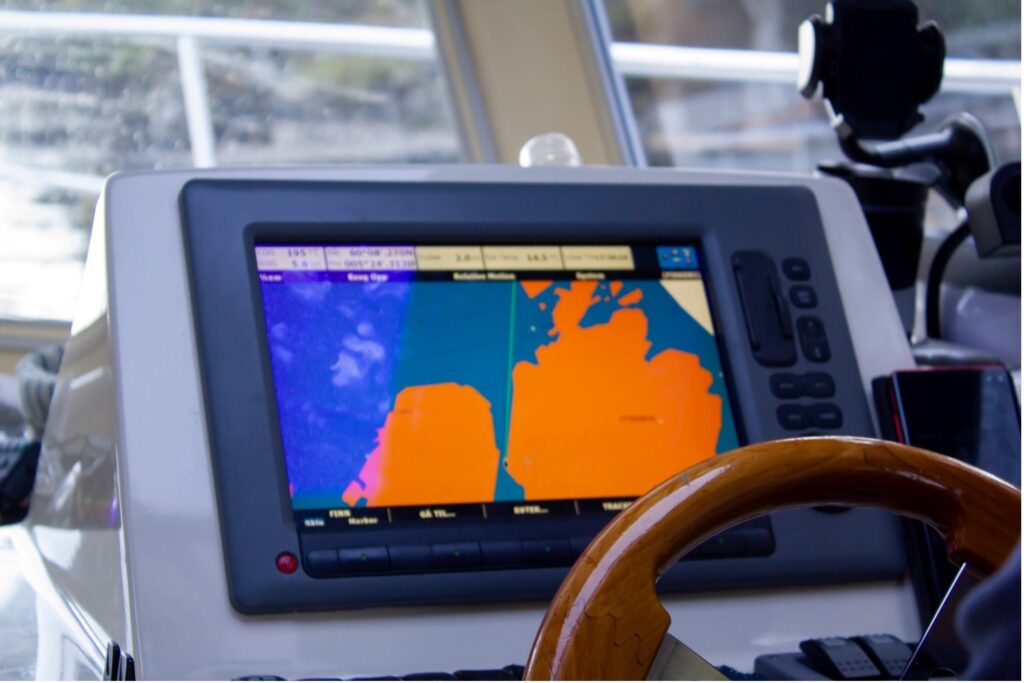
Looking into the seamless integration of modern marine GPS technology with other essential navigation systems, charting a course toward enhanced situational awareness and navigation efficiency on the high seas. First and foremost, let’s talk about electronic chart displays, which have become indispensable tools for sailors navigating unfamiliar waters. By integrating GPS data with electronic charts, sailors can visualize their positions in real-time, allowing for precise course plotting and navigation. This integration not only enhances navigational accuracy but also provides valuable information such as depth contours, navigational hazards, and buoy locations, empowering sailors to make informed decisions as they navigate treacherous waters.
Now, let’s set our sights on radar, a vital tool for detecting obstacles, other vessels, and adverse weather conditions on the horizon. When combined with marine GPS technology, radar systems can overlay GPS-derived position data onto radar displays, providing sailors with a comprehensive picture of their surroundings. This integration enables sailors to identify potential collision risks, track nearby vessels, and navigate safely through congested waterways, even in low visibility conditions. By seamlessly integrating radar with GPS technology, sailors can navigate with confidence, knowing that they have a clear understanding of their surroundings at all times.
Let’s not forget about the Automatic Identification System (AIS), a revolutionary technology that allows vessels to broadcast their positions, course, and speed to nearby ships and shore-based stations. By integrating AIS data with GPS technology, sailors can track the movements of nearby vessels in real-time, enabling them to make informed decisions to avoid collisions and navigate safely through busy shipping lanes. This seamless integration of AIS with GPS enhances situational awareness on the water, reducing the risk of accidents and ensuring safe passage for all vessels.
AIS plays a crucial role in providing essential separation distance information between vessels, particularly in congested maritime routes such as the channel. This real-time data enables sailors to make timely adjustments to their course, ensuring avoidance of potential collisions with ships navigating in busy shipping lanes. By leveraging AIS technology, sailors can proactively manage their vessel’s trajectory, pre-emptively sidestepping hazards and maintaining safe distances from other maritime traffic.
The significance of AIS becomes particularly pronounced during crossings of heavily trafficked waterways, where precise navigation is imperative. By utilizing AIS data, sailors can efficiently identify impending collision risks and execute strategic manoeuvres to mitigate them. Whether altering course or adjusting speed to facilitate the safe passage of larger vessels, AIS empowers sailors with comprehensive situational awareness, fostering navigational confidence and foresight in traversing dynamic maritime environments. Thus, AIS emerges as an indispensable tool, augmenting maritime safety protocols and enhancing navigation precision for seafarers navigating through bustling maritime corridors.
In the dynamic world of modern maritime navigation, the integration of GPS technology with electronic chart displays, radar, and AIS represents a giant leap forward in enhancing navigational efficiency and safety on the high seas. By harnessing the power of these integrated systems, sailors can navigate with confidence, knowing that they have access to accurate positioning data and a comprehensive understanding of their surroundings, even in the most challenging conditions.
Safety Features and Emergency Response:
In the realm of contemporary marine GPS systems, safety features stand as pillars of assurance, designed to safeguard sailors against unforeseen perils on the open water. Among these features, man overboard (MOB) alerts reign supreme, offering a lifeline in critical moments of distress. Through GPS-enabled MOB technology, vessels can swiftly pinpoint the precise location where a crew member has fallen overboard, enabling rapid response and facilitating timely rescue operations. This capability not only bolsters the chances of successful retrieval but also instils a sense of reassurance among crew members, knowing that help is readily available in the event of an emergency.
Moreover, collision avoidance capabilities integrated into modern marine GPS systems serve as vigilant guardians of maritime safety. Leveraging advanced sensor technologies and real-time data analysis, these systems continuously monitor surrounding vessels, assessing potential collision risks and issuing timely warnings to navigators. By providing actionable insights and facilitating evasive manoeuvres, collision avoidance features mitigate the likelihood of maritime accidents, fostering a secure environment for vessels traversing congested waterways. With such safety measures seamlessly woven into contemporary marine GPS systems, sailors can navigate with confidence, knowing that their vessels are equipped with the tools necessary to navigate perilous waters safely.
Connectivity and Remote Monitoring:
In the ever-evolving landscape of maritime navigation, marine GPS technology stands as a beacon of innovation, leveraging connectivity options to enhance vessel management and operational efficiency. Through satellite communication and internet connectivity, modern GPS systems enable remote monitoring, offering sailors real-time insights into vessel performance and location. This connectivity facilitates seamless communication between vessels and onshore command centres, empowering fleet managers to monitor operations remotely and make informed decisions in real-time.
Furthermore, marine GPS technology plays a pivotal role in fleet management, offering comprehensive tools for tracking and optimizing vessel movements. By harnessing GPS data, fleet managers can monitor the location and trajectory of each vessel in their fleet, enabling efficient allocation of resources and scheduling of maritime activities. Additionally, GPS-enabled asset tracking capabilities provide visibility into the status and condition of onboard equipment and cargo, streamlining logistical operations and enhancing supply chain management.
Data analytics emerges as a linchpin in the optimization of vessel operations and fuel efficiency, facilitated by the wealth of information captured through marine GPS technology. By analysing GPS data, including vessel speed, route efficiency, and fuel consumption, maritime operators can identify areas for improvement and implement strategies to enhance performance. Whether it’s optimizing route planning to minimize fuel consumption or adjusting vessel speed to reduce emissions, data-driven insights empower sailors to operate their vessels more sustainably and cost-effectively. Thus, through the integration of connectivity options and data analytics, marine GPS technology revolutionizes vessel management, fostering a more efficient and environmentally conscious approach to maritime navigation.
Future Trends and Emerging Technologies:
As we navigate towards the horizon of maritime innovation, the future of marine GPS technology holds boundless possibilities, propelled by emerging trends and cutting-edge technologies. One such frontier is the integration of Artificial Intelligence (AI) into navigation systems, revolutionizing the way vessels traverse the seas. AI-powered navigation systems utilize advanced algorithms to analyse vast amounts of data, enabling autonomous decision-making and route optimization. By harnessing the predictive capabilities of AI, sailors can navigate with unprecedented precision and efficiency, ushering in a new era of intelligent maritime navigation.

Furthermore, the rise of autonomous vessels represents a paradigm shift in maritime operations, driven by advancements in GPS technology and autonomous navigation systems. These unmanned vessels, equipped with sophisticated sensors and GPS-enabled autonomy, have the potential to revolutionize cargo transportation, offshore exploration, and maritime surveillance. By eliminating the need for onboard crew members, autonomous vessels offer increased safety, operational efficiency, and cost-effectiveness, reshaping the maritime industry as we know it. There were several autonomous ships in operation, primarily in the experimental or testing phase. However, the number of fully autonomous ships actively operating in commercial maritime routes is limited. The development and deployment of autonomous vessels are ongoing, with various companies and research institutions working on advancing the technology and overcoming regulatory hurdles.
In addition to AI-powered navigation and autonomous vessels, the integration of GPS with emerging technologies like blockchain holds promise for enhancing data security and transparency in maritime operations. Blockchain, a decentralized ledger technology, ensures secure and tamper-proof transmission of GPS data, enabling verifiable tracking of vessel movements and cargo transactions. By leveraging blockchain-enabled GPS systems, sailors can mitigate the risk of data manipulation and unauthorized access, fostering trust and accountability in maritime transactions. As we sail towards the horizon of innovation, these emerging technologies will continue to shape the future of marine GPS, empowering sailors with the tools and capabilities to navigate the seas with confidence and foresight.
Final Thoughts
In the dynamic realm of maritime navigation, the integration of GPS technology with electronic chart displays, radar, and Automatic Identification System (AIS) represents a monumental leap forward in enhancing navigational efficiency and safety on the high seas. The fusion of these integrated systems provides sailors with comprehensive situational awareness, empowering them to navigate with confidence and precision, regardless of the challenges they may encounter. Looking to the horizon of maritime innovation, emerging technologies such as Artificial Intelligence (AI), autonomous vessels, and blockchain-enabled GPS systems hold promise for revolutionizing navigation efficiency and data security in the years to come.
As sailors chart their course through the digital seas, one thing remains certain: the relentless pursuit of innovation will ensure they have the tools and capabilities to navigate with confidence and foresight, guiding them to new horizons of exploration and discovery. We invite you to join the discussion and share your thoughts on the blog. What do you envision for the future of marine GPS technology? How do you think emerging technologies will shape maritime navigation? Your insights and perspectives are invaluable as we navigate towards a future of safer, more efficient, and sustainable maritime travel. Leave a comment below and let your voice be heard in shaping the conversation on the evolution of marine GPS technology.